


|
|
Mt.Paektu - the birthplace of Korean revolution
HOW TO GET THERE | WHAT TO WEAR | BEST TIME TO VISIT | MT.PAEKTU | MAP | RIMYONGSU FALLS | SAMJIYON | GRAND MONUMENT | SECRET CAMP | HOTELS | TOURS TO PAEKTU | AROUND PAEKTU
Paektu, or Paektu-san, or Baekdu-san means "white head mountain" in Korean. The name of this mountain in Chinese is Changbai Mountain. Paektu is the most beatiful mountain in Korea and is located on the border between North Korea and China. At 2750 m (9,003 ft), it is the highest mountain of the Changbai and Paektudaegan ranges. It is also the highest mountain on the Korean Peninsula and in northeastern China.
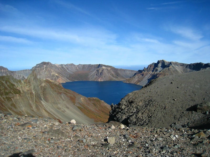
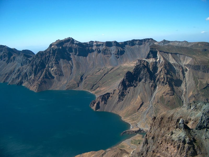
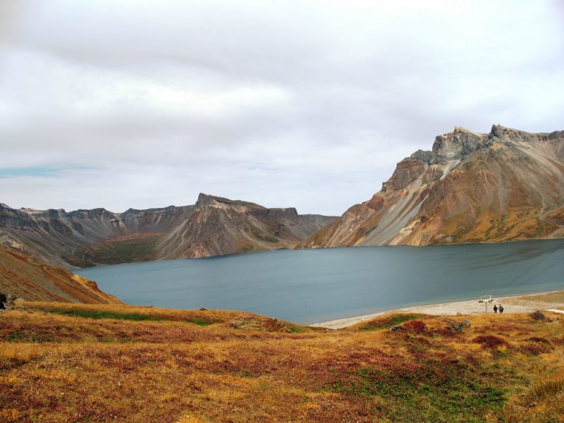
The huge crater lake called Chon ("Lake of Heaven") lies at the summit, surrounded by bare rocky crags. It is the deepest crater lake in the world, and also one of the coldest. The Lake Chon is the source of the two longest Korean rivers - Amnok (803 km) and Tumen (521 km) which serve as Sino-Korean border almost over its entire length.
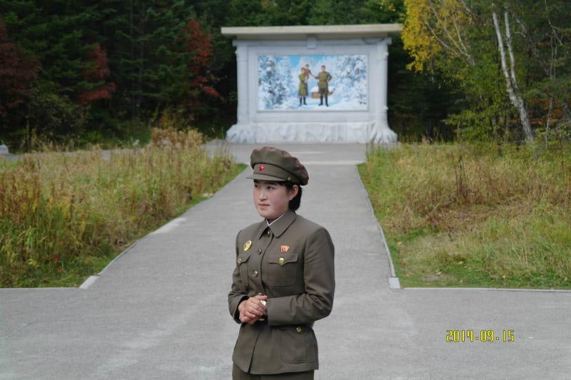
The area around the mountain is dotted with revolutionary historical sites and secret camps connected with Korean guerrilla fight against the Japanese, who held the Korean Peninsula as a colony until their 1945 surrender ended the World War II.
Koreans consider Mount Paektu not only as a heart of Korean Revolution but also as the place of their ancestral origin and as a sacred mountain, one of the three "spirited" mountains (Jirisan, Hallasan and Paektusan); the one contained in the legendary foundation of Korea.


How to Get There
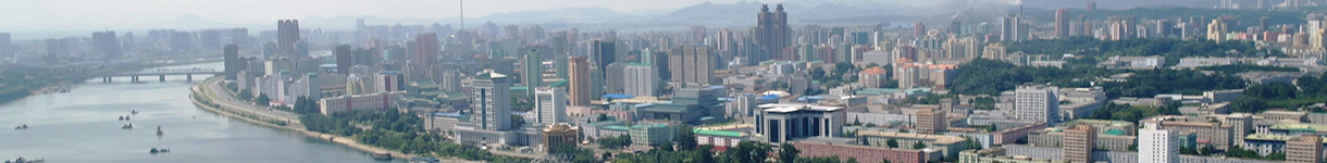
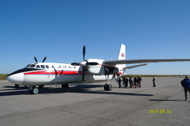
Mt. Paektu is located in the northwest of Samjiyon County at the border with China, 385 km from Pyongyang. The summit of the mountain is accessible only from May to September, and for most of the winter is not accesible at all from the DPRK side. The only way for foreign tourists to get to Paektu is by plane from Pyongyang to Samjiyon airport.
There is another way to Mt.Paektu which is currently available only for locals: take train to Hyesan city (67 km from Samjiyon) and then drive to Mt.Paektu.


What to wear
Mt. Paektu belongs to the coldest zone in North Korea and the weather is prone to sudden changes. The wind on the mountain top is often strong and cold, so warm clothes are needed in all seasons. If you travel to Paektu we recommend you to take with you:
- waterproof/ hiking footwear, good for mountain walk
- raincoat
- sweather
- sun glasses (can be even used to protect against the wind mixed with the sand)
- sun protection cream (the sunshine on the top can be very strong)
Best time to visit
Mt.Paektu is characterized by cold continental climate. Spring begins in late May and temperature reaches no more than +20C in summer. Winter lasts 8 months. The lake is covered by ice till June and in October it is already covered with snow. July and August are usually rainy and cloudy; thus the best time to visit Mt.Paektu is September.
Mt. Paektu
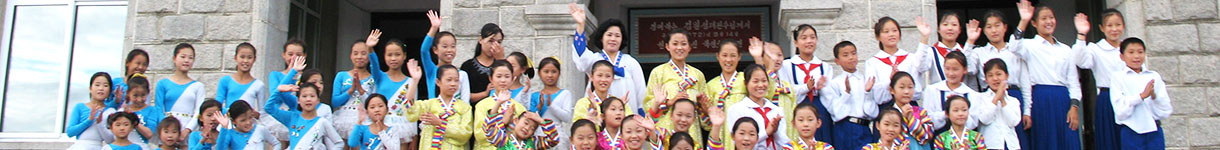
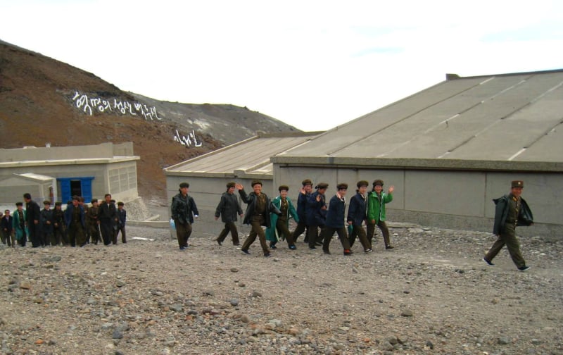
Mt.Paektu is the most famous among five celebrated mountains of Korea. The leader Kim Jong Il was born here in 1942 in one of the secret camps. Tens of thousands of North Koreans visit the mountain for political education tours each year during the summer months, when the snow has melted enough for it to be accessible. The Sino-Korean border runs just in the middle of Chon Lake on the summit of Mt.Paektu. The Chinese side is easily viewed from the top.
At the foot of the mt.Paektu


At the summit of Mt.Paektu
Paektu is an active volcano which last erupted in 1903. More than a thousand years ago (950 AD) Paektu was the site of one of the biggest eruptions in human history, blanketing eastern Asia in its ash. The huge explosion caused the volcano’s crater to collapse, forming a 4 km-wide hole, today the site of a giant lake.
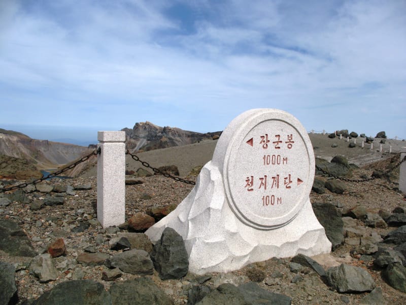
Janggun Peak
The highest peak in Mt. Paektu, it is 2750 m high above sea level. It is the highest peak in Korea. It is composed of sheer cliffs down to the Lake Chon and 20 to 30 degrees slopes. Koreans consider sunrise on Mt.Paektu "the sunrise of Korea".
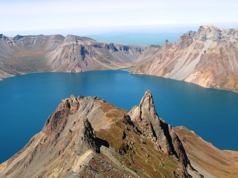


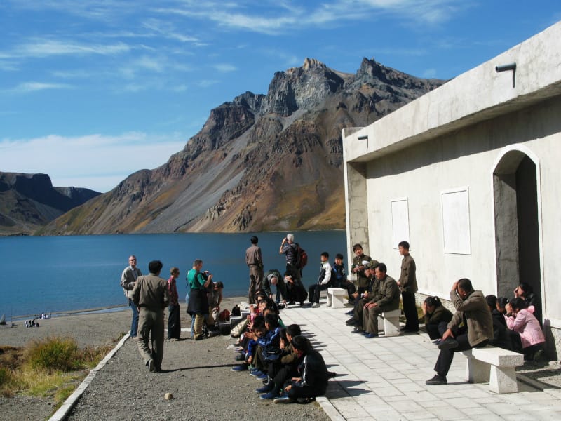
Lake Chon
Lake Chon is the scenic spot rare to be found in the world for its area of 9165 square meters and natural scenery. The surface of the lake is located 2190 m above the sea level in the mountain crater and surronded by 216 peaks. The lake is the deepest mountain lake in the world - the average depth is 213 m and the maximum depth is 384 m. The water freezes from mid-October to mid-June. On the northern shore there are 3 hot spas with diametre of 50 cm each and a dozen of smaller hot spas.


Up to the mountain summit and down to the lake
There are several ways to get to the summit:
- From the parking lot go on foot to the summit along the curvy road, it takes about 40 min
- From the parking lot take a funicular to the summit of the Mt. Paektu, it takes about 5 min. The funicular operation is not stable due to frequent electricity blackouts. Ticket fee is payable in cash on spot
From the summit there are several ways to the Chon lake in the crater:
- Take stairs all the way down to the lake
- Take cable car to the lake. Please note that cable car is often not in operation due to electricity blackouts. Ticket fee is payable in cash on spot


Chongun Rock, road along Amnok river and Chinese border
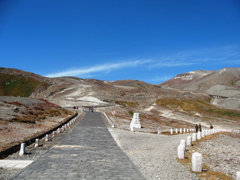
Amnok River (Chinese name Yalu) is the 803 km long border river between North Korea and China and it is the longest river in the DPRK. Amnok River has Mt. Paektu as a watershed and starts on the southern foot of the mountain. To go to the Secret Camp and Kim Jong Il's Native Home from Mt.Paektu's summit there is a road along Chinese border and Amnok river. This road features picturesque views especially on Chongun rock in river's bed. Along the way there are several beatiful observation spots where you can have open air picnic and enjoy amazing views of Amnok river and China.


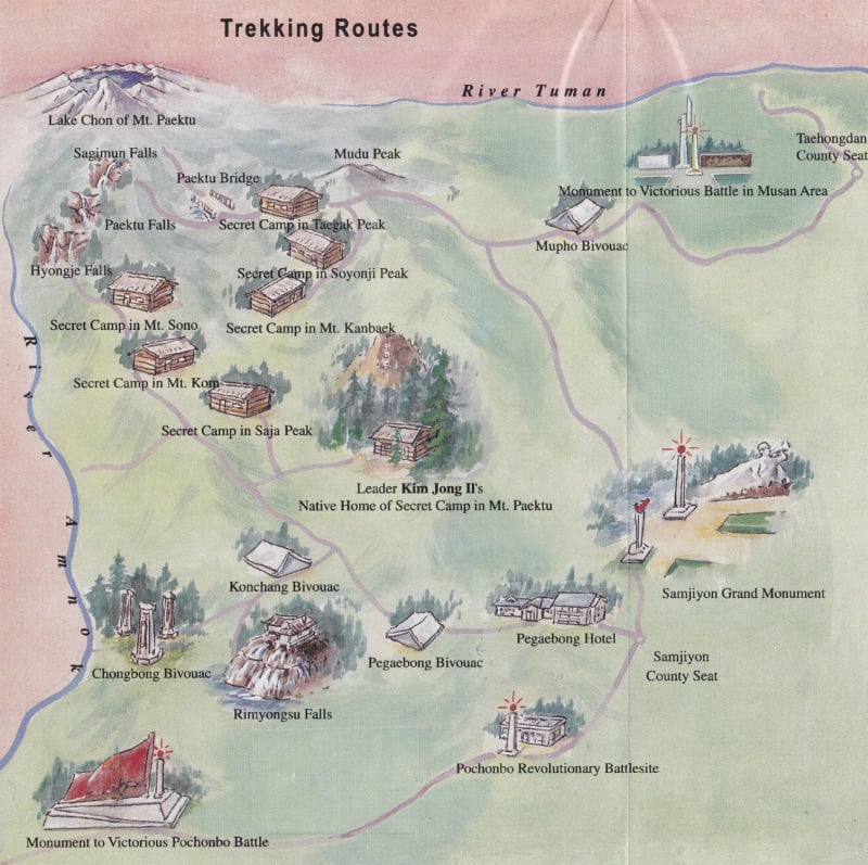
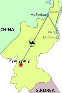
Main Attractions and Map of Mt.Paektu Area
1. Mt.Paektu |
4. Native Home and Secret Camp |
|
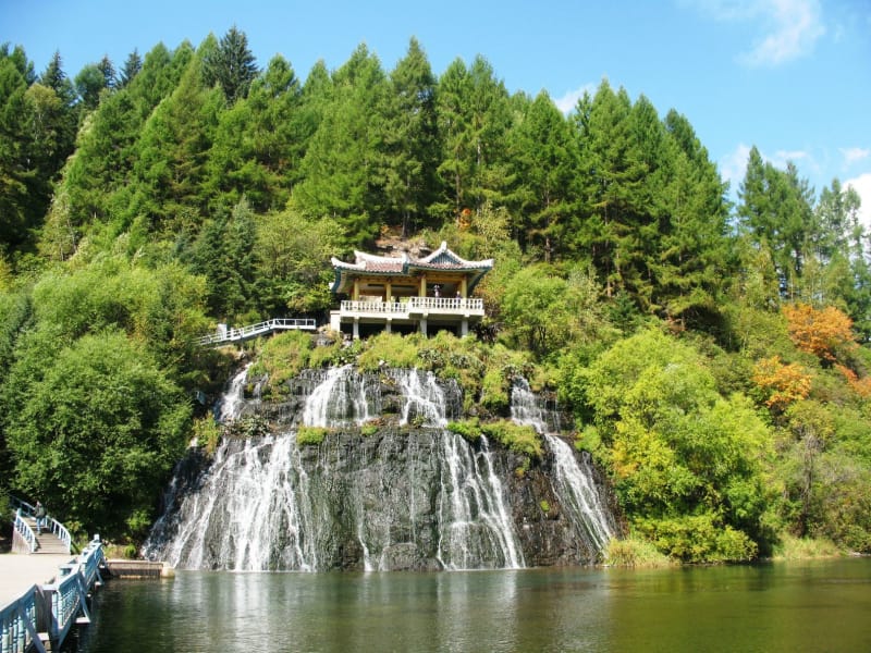
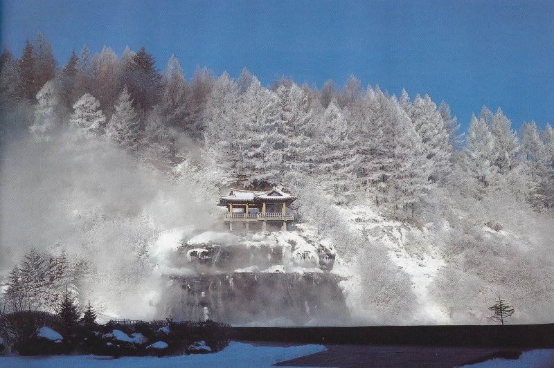
Rimyongsu Falls and Village
Rimyongsu Falls are unique falls taking its source in the Lake Chon on Mt.Paektu. It consists of 42 big and small falls within 4 km-section. There are 9 outlets with the average height is 6 m. Below the falls there is river Rimyongsu. These falls are beautiful all year around, but in winter they present an especially spectacular view.


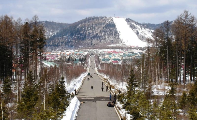
Samjiyon
Samjiyon is a beautiful mountain town 1380 m above sea level and is a known ski resort in the DPRK. Samjiyon takes its name from three lakes in the county, which are known as the Samjiyŏn. Samjiyŏn is situated near Mt. Paektu (50km) and is used as a base for traveling in the area.
Now "Samjiyon" is used as a brand name for the home-produced Android-based tablet preloaded with the complete works of Kim Il Sung and a local version of Angry Birds.


Lake Samji & Samjiyon Grand Monument
Lake Samji is located near Samjiyon town and it is used to be a river more than one million years ago. It turned into a lake in the process of Mt.Paektu eruption when volcanic lava blocked the river stream. Lake Samji consists of three pools located side by side - therefore the name "Samji" means "three pools".
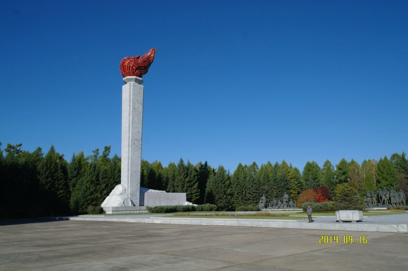
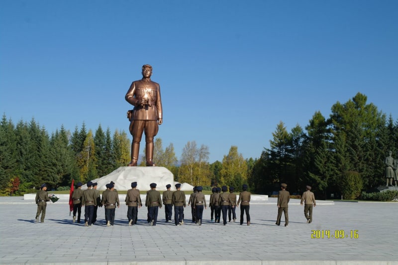
Samjiyon Grand Monument
This impressive monument is standing on the shore of Samji lake with Mount Paekdu as background. It is the second biggest monument to Kim Il Song. Samjiyon Grand Monument was unveiled in May Juche 68 (1979) to commemorate President Kim II Sung's revolutionary activity during the anti-Japanese revolutionary struggle.
The monument depicts young General Kim Il Sung in a 19.7 m bronze statue. In the area within 250 m centered around the bronze statue stands a torch tower. On the right side of the Samjiyon Grand Monument there is the Samjiyon Revolutionary Museum displaying materials on the final attack for Korea's liberation army in the Musan area.

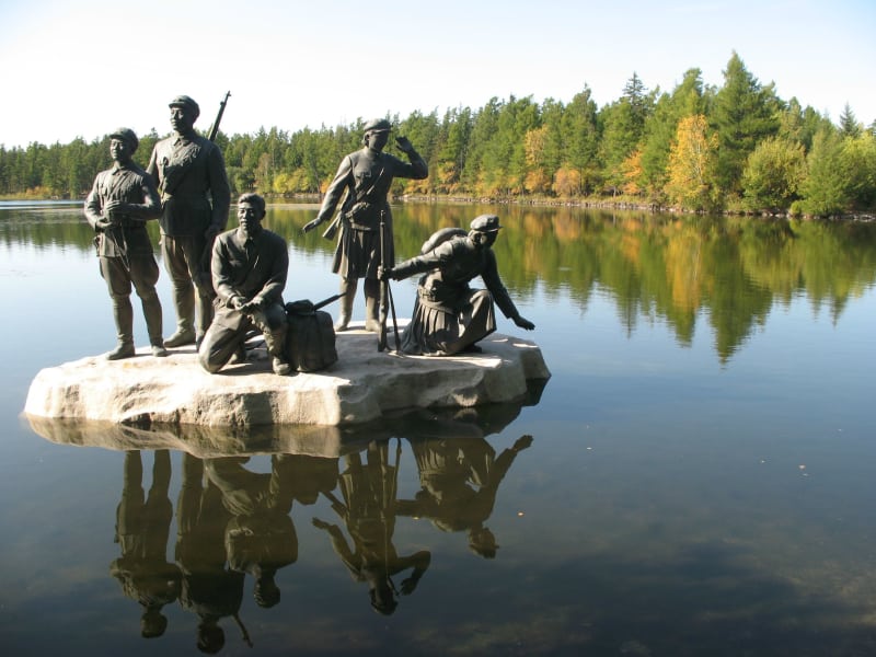


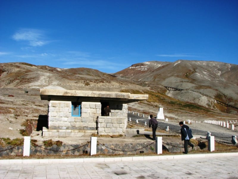
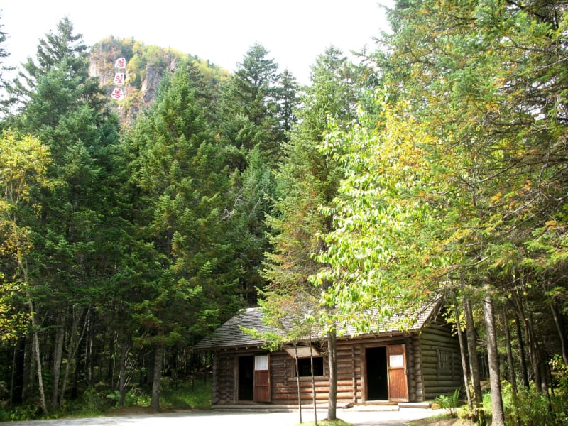
Paektusan Secret Camp
The Paektusan Secret Camp is an area where a number of secret bases (secret camp No.0 through No.4) were built according to the policy put forward by President Kim Il Sung at the Nanhutou Meeting in February Juche 25 (1936). These secret camps were hidden in forests and were not disclosed until Korea was liberated.
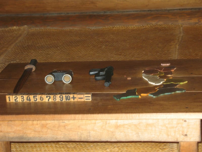
The secret camp No.1 served as headquarters of the Korean People's Army. Preserved here there are Native Home of the General Kim Jong Il, log cabins of headquarters, barracks of guards, a sewing workshop, a secreteriat, a printing house, an arms repair shop, slogan-bearing trees and other relics.
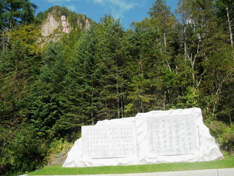
Jong Il Peak
The peak rises on Sobaeksu Valley. It is 1798 m high above the sea level. On the the peak there are three white granite boards displaying a message in Korean meaning "Jong Il Peak".
Ode Monument
It is the monumnet to the ode composed by President Kim Il Sung on the occasion of the 50th birthday of General Kim Jong Il.


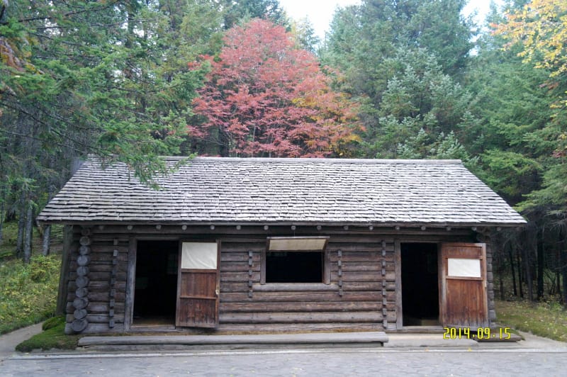
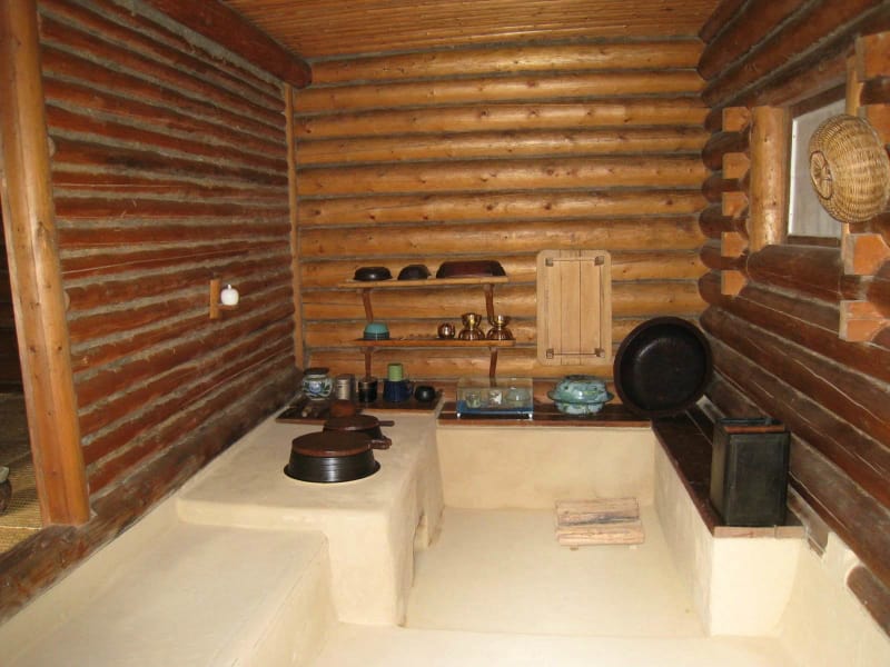
Native Home
It is a simple log cabin where the great leader Comrade Kim Jong Il was born on February 16, Juche 31 (1942). Preserved here there are toys, quilts and blankets used by young Kim. Slogan-bearing trees engraved by guerillas in praise of his birth grow around the home.

Hotels
In Mt.Paektu area there are several accommodation options:
- Pegaebong Hotel - located at Samjiyon town, it consists of 2 building, 130 rooms: 4 deluxe rooms, 9 standard rooms, 117 economy rooms
- Hyesan Hotel - located at the Hyesan city centre, it has 38 rooms


Our Tours including Mt.Paektu
We have group and individual tours visiting Mt.Paektu. Drop us a message to check what options are available for you: postmaster@koreakonsult.com
Around Mt.Paektu
- Taehong Plain Area - this site is associated with the Taehongdan Battle, the biggest battle in the homeland: Taehongdan Revolutionary Battle Site, Sinsadong Revolutionary Site
- Hyesan-Pochon Area - provincial capital of Ryanggang Province: Hyesan, Monument to Victorious Pochonbo Battle, Kwaegung Pavilion, Pochon
Other Korean Mountains
There are five celebrated mountains in Korea, and you can check out other four:
- Mt.Kumgang - on the east coast near South Korean border
- Mt.Chilbo - on the east coast near Rason Free Economic Zone
- Mt.Myohyang - from Pyongyang 160 km to the north
- Mt.Kuwol - on the west coast near Pyongyang